Earth Engine Raster Analytics in BigQuery: Bringing Planetary-Scale Geospatial Analysis into the Data Warehouse
for googlE cloud & geo
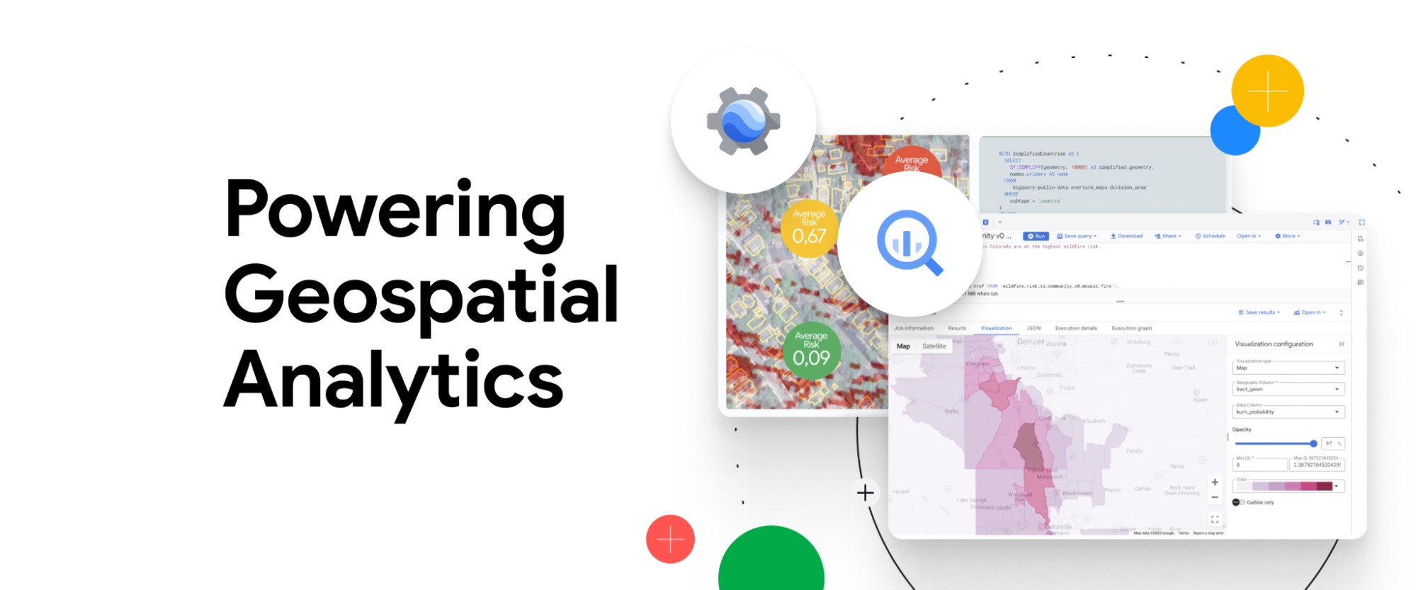
I led the UX vision and product definition for integrating raster geospatial analytics from Google Earth Engine directly into Google BigQuery, enabling analysts to combine satellite imagery with large-scale data workflows inside a single analytics environment.
Opportunity and Problem:
The initial program began with a bold but highly ambiguous idea: build a comprehensive geospatial visualization system within BigQuery. However, there was no clearly defined user need, product-market fit, scope, or timing strategy. Without a clear understanding of how analysts and researchers needed to use geospatial visualization within their analysis workflows, the effort risked becoming a large, unfocused engineering investment.
To ground the initiative, I conducted several workshops with product managers digging deep into assumptions and ideas. We then talked to experts - scientists, climate researchers, and advanced analysts working with satellite and raster datasets. This research identified opportunities within the full workflow from exploration and prototyping to large-scale analysis, revealing where users experienced the most friction. All these insights helped reshape the initiative around a more focused opportunity: enabling raster analysis and visualization inside Query results to enhance query prototyping while creating a Cloud native, integrated product experience.
My Role and Responsibilities:
Leadership & Product Strategy
Defined the UX vision and product direction for geospatial raster analytics in Google BigQuery during a highly ambiguous early phase with no clear scope, user need, or market timing. Partnered with senior product and engineering leaders to shape a focused roadmap and align the BigQuery organization around a cohesive integration strategy.
Expert Research & Problem Definition
Conducted expert research with geospatial scientists, climate researchers, and advanced analysts using Google Earth Engine to understand the full analysis lifecycle—from exploration and prototyping to large-scale computation—identifying the highest-value opportunities for integration.
Design Vision & Product Impact
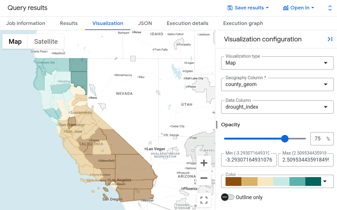
Led the end-to-end UX for integrating raster analytics natively into Google BigQuery, advocating for a product experience that felt organic rather than additive. This included reducing interface clutter (combined all types of visualization under one tab for ease of use), improving clarity in system feedback and error states, and establishing clearer interaction patterns for complex geospatial workflows. By strategically focusing the scope, we accelerated time to market, avoided significant engineering investment in lower-value capabilities, and enabled the team to learn quickly from real customer usage.